West Penwith: ancient sites and alignments
Map showing the ancient sites of the Land's End peninsula, the Isles of Scilly, the Lizard and 'East Penwith', together with known alignments in the area. These sites date from 700 to 5,000 years ago - the Medieval to the Megalithic periods.
See the map below or click here to view larger version on Google Maps.
This map incorporates the collected work of many researchers over at least four decades, as recorded in the pages of Meyn Mamvro, and on the list of Alignments.. Hopefully the work of further researchers will be added in due course.
This is a work in progress, started in early December 2014. It is as yet unfinished, though it is now ready for public viewing and detailed peer review. You're welcome to take a look!
View larger version on Google Maps
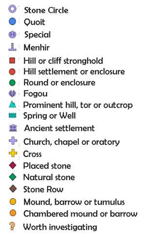
Key to symbols
 Tips on using the map:
- use the wheel on your mouse to zoom in or out of the map
- or double-click the map near the location you want to zoom in on
- and to shift location, click and drag the map
- click on a site or a line to get information about it
- click the little box at the top-left of the map to see the list of sites
- click the arrow at the bottom of the list to close it